Easily store and manage static data for their pressure equipment, including unlimited file attachments, inspection scheduling, task management, and management of change functionality.
AbaData’s Pressure Equipment Management Module is designed to automate the administrative, including data entry, data analysis, and reporting.
Identify any potential problems and take preventive measures to avoid costly downtime. The powerful task management feature allows managers to easily manage and track tasks.
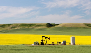
Access the most up-to-date well, pipeline and facility data for Western Canada, You can also access historic well production data, including cumulative production, ratios, and more.
AbaData reporting tools allows you query large datasets, and generate detailed reports for analysis. AbaData also provides extensive filtering tools to help you find the exact information you need quickly and efficiently. Easily create custom lists and save your searches for future use.
Reliable, quick and simple-to-access intelligence for reclamation and restoration leaders to prepare & execute environmental projects.
Retrieve site-relevant information, including survey plans, to identify regulatory obligations, mange land restoration conflicts, and review development history
Integrates high resolution, historical and current arial photography and satellite imagery.
Visualize Phase 1 & Phase 2 site assessments, seed zones and natural subregions, species at risk boundaries, detailed soil data and more.
The industry’s only suite of software tools to optimize performance in the field. Transform outdated inspection cycles, track progress of activities, improve performance, manage risk, and much more all from one software solution.
With numerous modules to choose from, companies can customize their software to fit their specific needs. All data is synced to the cloud, allowing for access from the field and HQ through the AbaData Maps 3.0 web interface.
The application includes an offline functionality, allowing field operators to download assignments before heading to the field and complete their work without an internet connection. This ensures that work can continue uninterrupted, even during technical issues or outages.
Get access to detailed land data, including HRVs, to help you make informed decisions quickly
Data layers specifically designed for federal lands and Crown Mineral Agreements.
Stay informed and up-to-date on infrastructure information.
Use AbaData's filtering system allowing you to search by owner or disposition type.
Get access to registered plans and surveys, federal lands and Crown Mineral Agreements, and use DIDS to filter by owner and disposition type.
Get access to registered plans and surveys, federal lands and Crown Mineral Agreements, and use DIDS to filter by owner and disposition type.
Extensive utility infrastructure data, including FORTIS power and rural low-pressure gas lines, electrical utilities, communication utilities, and more.
Use AbaData LITEning to get turn-by-turn directions, track your current location on the map, and trace roads that have been travelled. Both mobile versions and an offline app are available for use on smartphones and tablets, so you can take AbaData with you anywhere, even in areas with no cell service.
Licensed pipeline data, registered plans of survey data including pipeline ROWs.
Extensive utility infrastructure data, including rural low-pressure gas lines, electrical utilities, communication utilities, and more.
Both mobile versions and an offline app are available for use on smartphones and tablets, so you can take AbaData with you anywhere, even in areas with no cell service.
Use AbaData LITEning to get turn-by-turn directions, track your current location on the map, and trace roads that have been travelled.
AbaData provides access to datasets from Alberta Energy Regulator (AER), British Columbia Oil and Gas Commission (BCOGC), and Saskatchewan Energy and Resources (MER). Filter and download the datasets in various formats.
AbaData’s Shape File builder allows users to submit new permits, line splits and amendments, and retro-active licensing for pipelines. The Shape File builder simplifies the process of creating and submitting pipeline submissions, enabling users to quickly and accurately complete their work.
AbaData’s landslide susceptibility mapping helps users to identify areas that are vulnerable to landslides. By using the mapping feature, users can assess the risk of landslides in certain areas and make informed decisions about the potential impact on their operations.
The pipeline signage management feature allows users to easily create, update, and manage signage in a single location. With AbaData, users can ensure that the information on their signage is up-to-date and accurate.
AbaData allows users to conduct field operation inspections with ease. The field operation inspections feature enables users to quickly and accurately assess the condition of their operations and identify any potential hazards or safety concerns. With AbaData, users can ensure that their operations are running safely and efficiently.
AbaData is designed to make risk management easy and efficient. Easily integrate your risk datasets to help you identify and track potential risks in your operations, so you can make informed decisions about your pipelines and their integrity.
With our integrated pipeline elevation graphing, you can quickly and accurately visualize your pipeline's elevations and slopes.
We understand the importance of data integrity and accuracy. We offer integration with third-party pipeline integrity data providers.
Access well survey plans for Alberta, Saskatchewan, and British Columbia and get access to historic and current satellite imagery.
AbaData is your comprehensive solution for land title and disposition data, land status reporting, title mapping layer and county maps information.
Our software enables you to easily link crown disposition data to the BADGR plan distribution system
Experience a safer and more reliable pipeline operation with TRIAGE integration. Fewer pipeline failures and reduced operational disruptions ensure a smoother journey for your operations.
Maximize your profitability with up to 45% cost savings achieved through precise data analysis and achieve better resource allocation and a more efficient operation.
Enhance the safety and reliability of your pipeline network, with real-time access to hazard assessment updates and mitigation guidance, empowering you to make well-informed decisions.
An offline fast-mapping engine of Western Canada with an intuitive interface & GPS tracking.
Learn moreThe most robust, accurate & comprehensive pipeline and well data in Alberta.
Learn moreAccess digital survey plans for the activity taking place on Crown Land for the Government of Alberta.
Learn moreWestern Canada’s leading mapping & visualization software solution displaying complete land & infrastructure information.
Learn moreTransform outdated inspection cycles and reduce risk by streamlining management of pigging, cathodic data, and more.
Learn moreManage your assets with features like file storage, inspection service and scheduling, tasks, and more.
Learn more