Take the essential features of AbaData Maps with you offline and make navigation easy with AbaData LITEning.
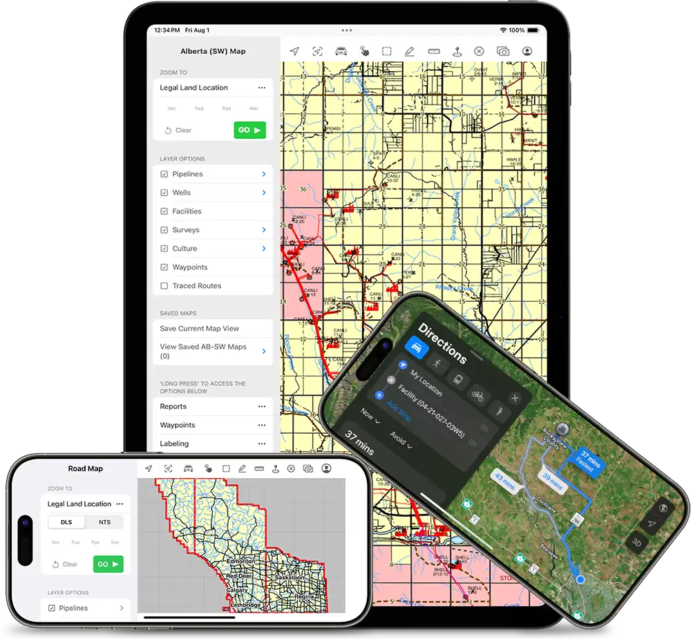

Available exclusively on the App Store, LITEning’s fast mapping engine of Western Canada makes navigation easy offline. LITEning features an intuitive interface with GPS tracking to quickly and accurately map roads, pipelines, survey boundaries, dispositions, and more. Track your current location on the map, and trace roads that have been travelled.
With AbaData LITEning, you can generate reports immediately, create map markups, and print maps quickly to share with colleagues or clients. Users can also share waypoints between the office and field, allowing office users to push locations to the field and the field to push locations and observations to the office.

AbaData LITEning subscriptions are available per individual user and billed annually. LITEning is now available on iOS.
“I have been using AbaData’s mapping program for over 10 years. The user interface is intuitive and easy to navigate, and the programs functionality has helped save a significant amount of time on mapping and data analysis tasks.”
“As a large enterprise with complex data needs, we’ve been thrilled with the suite of AbaData software tools. The flexibility and scalability of the platform have allowed us to customize our data solutions to meet our business requirements, and the user-friendly interface has made it easy for our teams to adopt.”
"We recommend AbaData to anyone serious about running a modern energy operation.”
